


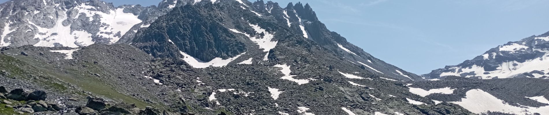
Val Thorens circuit des lacs

BernardAF
User
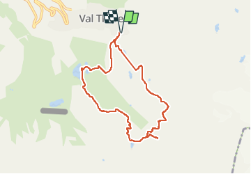

Length
8.4 km

Max alt
2634 m

Uphill gradient
377 m
Km-Effort
13.5 km

Min alt
2315 m

Downhill gradient
378 m
Boucle
Yes
Creation date :
2024-07-18 07:15:36.619
Updated on :
2024-07-18 11:45:29.434
4h18
Difficulty : Difficult

FREE GPS app for hiking
 SityTrail
IGN / Geographical institutes
SityTrail Plus
The world is yours!
About
Trail Walking of 8.4 km to be discovered at Auvergne-Rhône-Alpes, Savoy, Les Belleville. This trail is proposed by BernardAF.
Photos


23 photos in total. Please click on a photo to see them all in the gallery.
Positioning
Country:
France
Region :
Auvergne-Rhône-Alpes
Department/Province :
Savoy
Municipality :
Les Belleville
Location:
Saint-Martin-de-Belleville
Start:(Dec)
Start:(UTM)
310713 ; 5018588 (32T) N.
Comments